
More Blog Posts
Villa Digital
Engineering AG
Tittwiesenstrasse 21
7000 Chur
Alte Landstrasse 248
8708 Männedorf
Zugerstrasse 53
6340 Baar
Neugasse 12
9000 St. Gallen
2,114 laser scans in 1.5 days – Major project in Bern
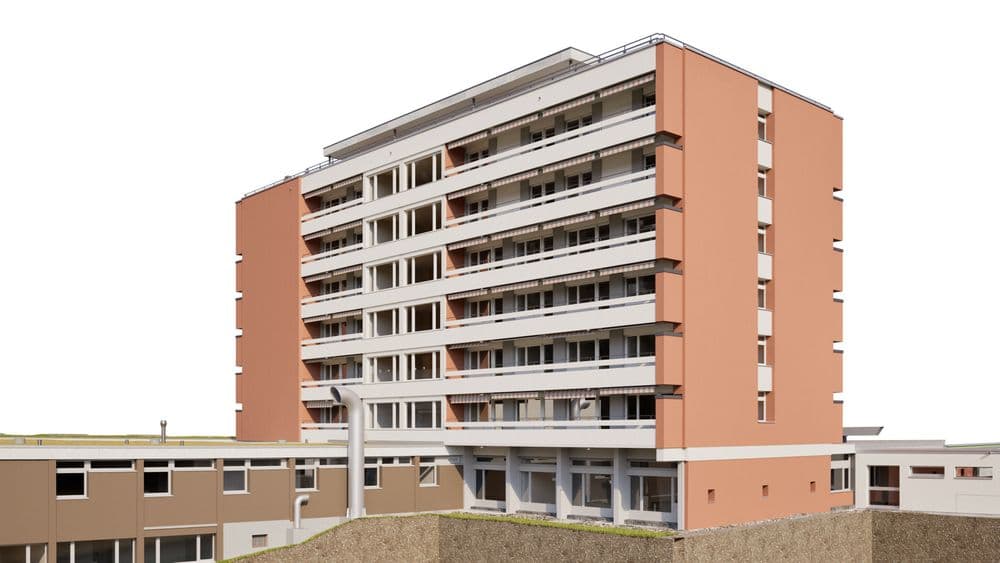
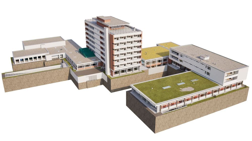
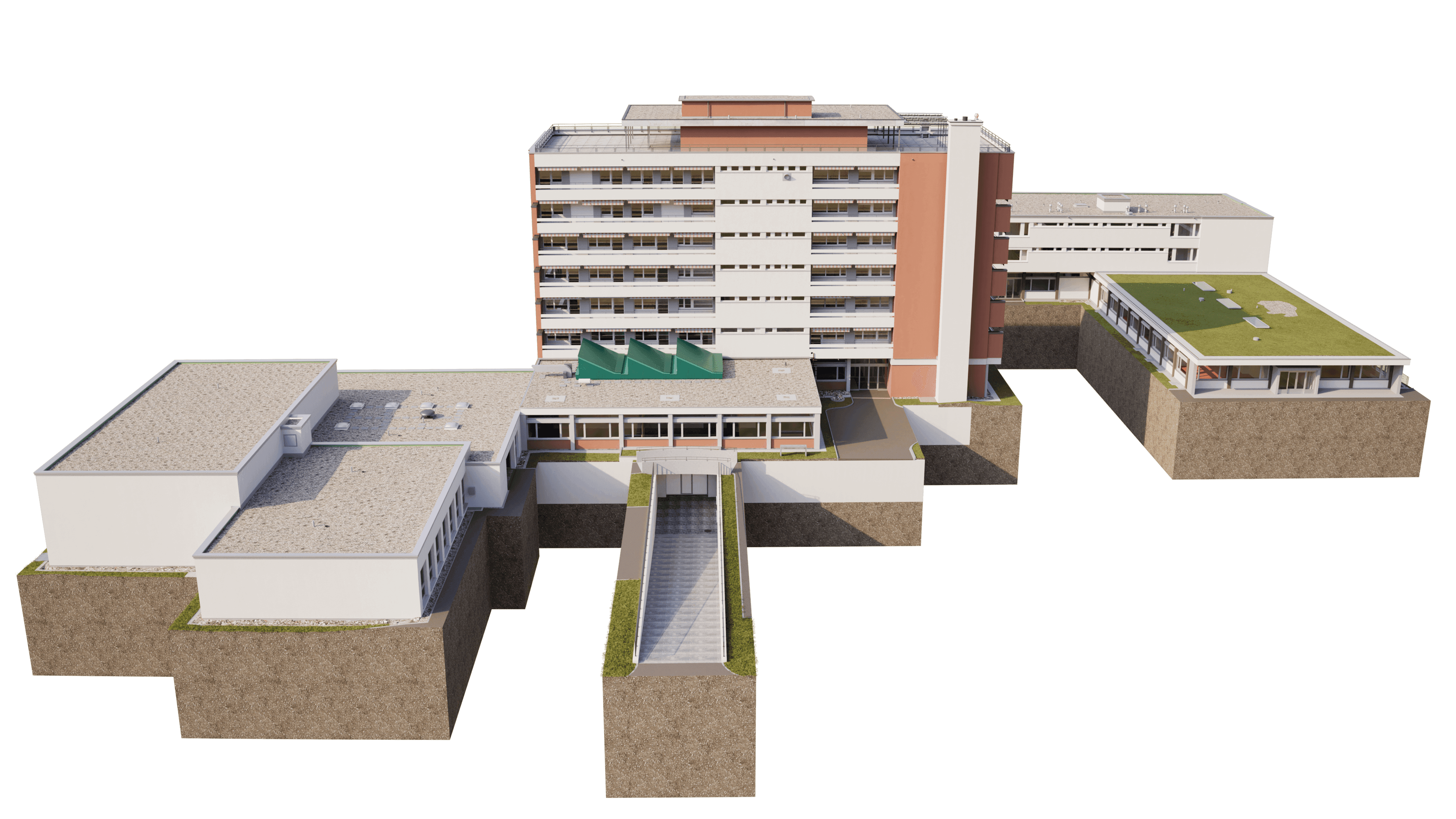
Three buildings, 2,114 laser scans, and just 1.5 days of on-site data collection: For a large-scale renovation project in Bern, we were tasked with fully digitizing an existing building complex and creating a detailed 3D as-built model from the data.
A reliable as-built basis is crucial for renovations and remodeling projects. Especially for larger buildings that have evolved over many years, existing plans do not always fully correspond to the actual physical condition of the structure. For this project, our task was to fully survey three buildings of a residential facility for people with disabilities and prepare them as a digital planning basis for the upcoming renovation.
2,114 scans in just 1.5 days
Four surveyors from VDE were on site simultaneously to perform the survey. We used our RIEGL VZ-600i and RIEGL VZ-400i terrestrial laser scanners. A total of 2,114 scan positions were captured in just 1.5 days.
This high number of scans was necessary to capture the three buildings—with their numerous rooms, corridors, stairwells, technical areas, and different floors—as completely as possible. Efficient on-site organization was particularly important, as the entire building complex remained in operation during the surveying work.
Surveying During Ongoing Operations
A facility of this size cannot simply be shut down for a survey. Residents and staff continued to move about the building, and normal daily operations continued as usual.
Our task, therefore, was not only to survey as precisely as possible but also to organize the survey in such a way that ongoing operations were disrupted as little as possible. Thanks to the simultaneous deployment of four surveyors and several laser scanners, the work was nevertheless completed within just one and a half days.
From the Basement to the Roof
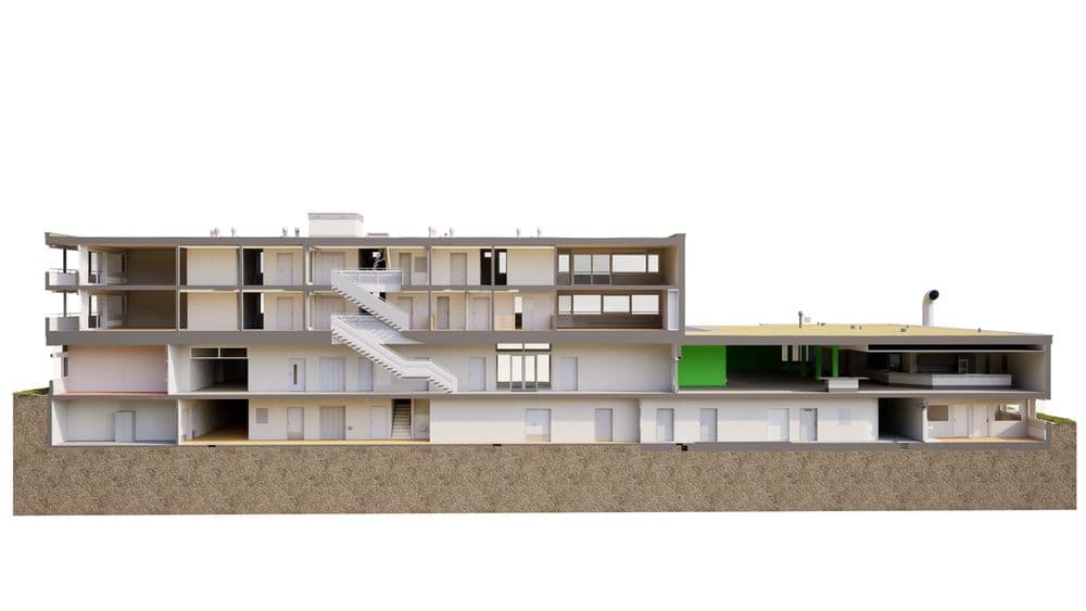
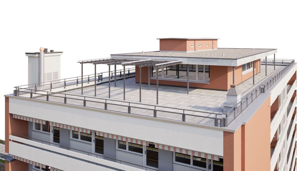
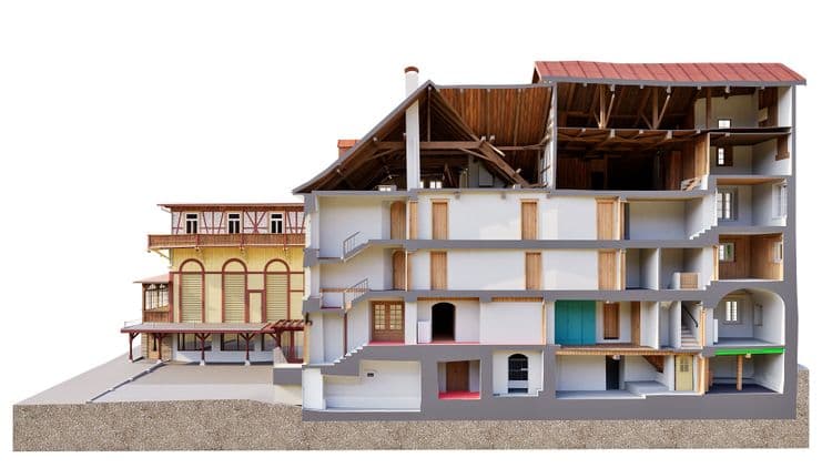
The scope of the project is also evident in the documentation produced. The survey covers the basement, ground floor, first through sixth floors, attic floor, and the roof plan.
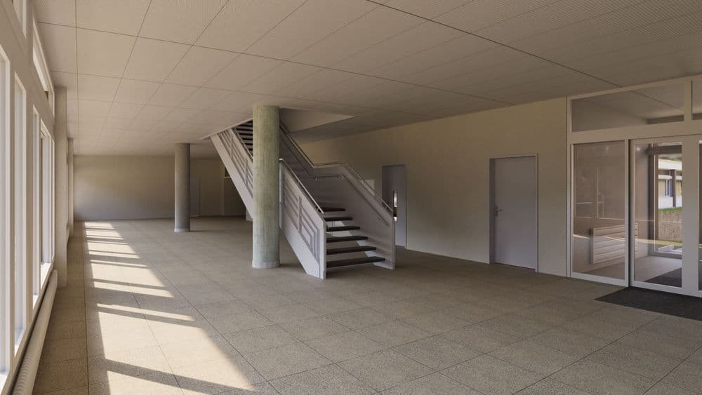
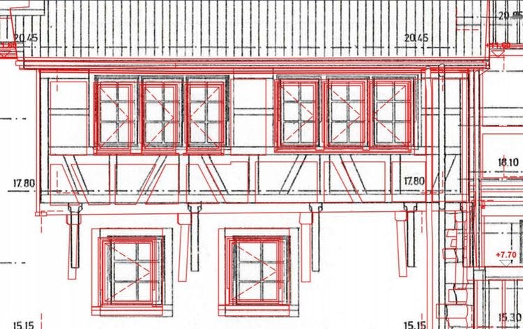
A detailed 3D building model was created based on the point clouds. The required 2D plans were then derived from this 3D model, including floor plans, 10 cross-sections, and 7 elevation views. In addition to the actual building geometry, the plans also include room areas, room heights, and specifications for floor, wall, and ceiling materials.
Different interventions require different levels of detail
For this project, the same level of detail was not required for all three buildings. The reason for this lies in the planned renovation. Different types of work are planned for the individual building sections.
Therefore, areas with more extensive planned interventions were developed using the Premium drawing standard. For other building areas, the Standard drawing standard was sufficient. The basements of all buildings were created entirely using the Premium standard. This ensures that further planning receives a higher level of detail precisely where it is actually needed.
Deformation-Compatible 3D Model in ArchiCAD 29
After the survey was completed, the recorded point clouds were used as the basis for the entire modeling process. The result is a deformation-accurate 3D as-built model in ArchiCAD 29.
The building is not simply idealized or straightened in the model. Existing deviations and deformations are accounted for in accordance with the actual conditions recorded.
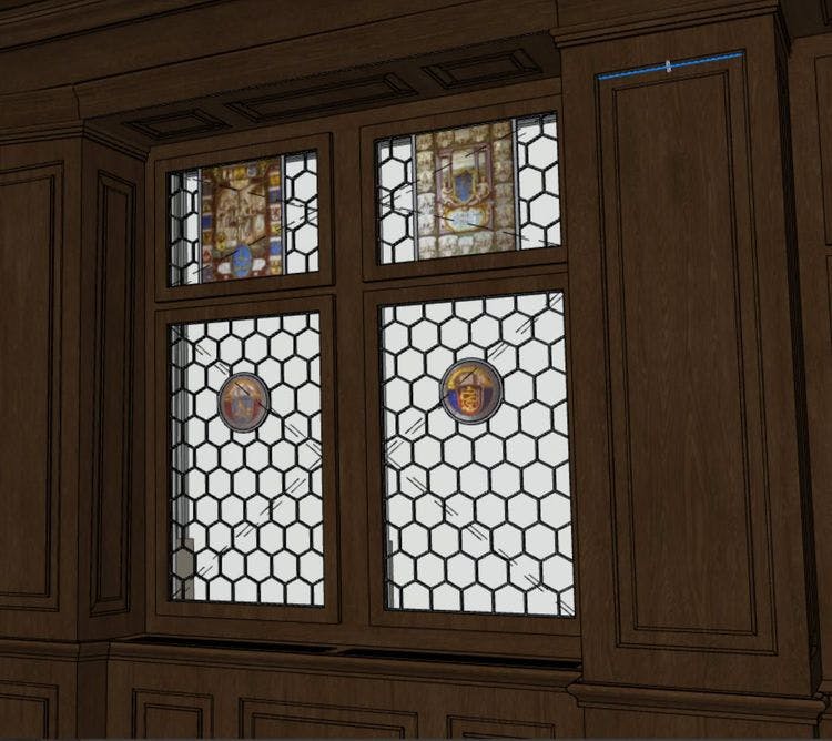
Where possible, modeling is performed using intelligent ArchiCAD library elements. Morph elements are used only where they are actually necessary due to the existing geometry. This results in a model that is based not on a theoretical new-construction state, but on the actual existing structure.
A Central Foundation for Renovation Planning
The goal of the entire survey was to create a reliable digital foundation for the upcoming renovation. Architects and specialist planners can thus access a unified 3D model and base their further planning on the actual surveyed existing structure.
The data was delivered in ArchiCAD 29, DWG, DXF, and PDF formats. In addition, the RiPANO point cloud viewer was made available. This allows the surveyed existing structure to be viewed virtually even after the survey is complete. Individual areas and details can be examined directly in the point cloud without having to return to the site for every follow-up inquiry.
From scan to finished model in about 40 days
It took approximately 40 days from the on-site survey to the complete delivery of the 3D model and the plans derived from it. During this time, the 2,114 laser scans were processed, the point clouds were merged, and the comprehensive 3D as-built model—including floor plans, sections, and elevations—was created.
This provided the client with a comprehensive and immediately usable digital foundation for further renovation planning within a short period of time.
Building Surveying as a Digital Planning Basis
The project in Bern clearly demonstrates what is possible today with modern laser scanning technology. Three buildings, numerous floors, 2,114 scan positions, and ongoing building operations—all captured in just 1.5 days.
The survey results in not just a point cloud, but a directly usable digital planning foundation for the subsequent renovation. For us, modern building surveying therefore means:
Capture the data precisely once—then plan digitally and reliably from there.