More Blog Posts
Villa Digital
Engineering AG
Tittwiesenstrasse 21
7000 Chur
Alte Landstrasse 248
8708 Männedorf
Zugerstrasse 53
6340 Baar
Neugasse 12
9000 St. Gallen
3D As-Built Model: How Accurate Is the Survey?
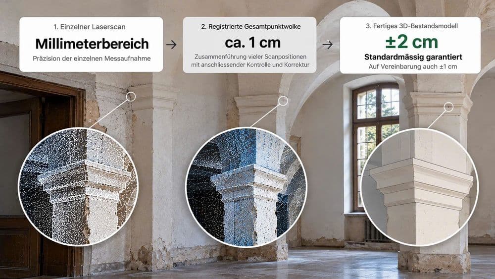
Modern 3D laser scanners measure in the millimetre range. Does that automatically mean the finished 3D as-built model is just as precise? Not necessarily. What matters is the entire processing chain: from data capture through registration and quality control of the point clouds to the finished CAD or BIM model.
Manufacturers specify impressive values for professional terrestrial laser scanners. However, the measurement accuracy of a single scan is not the same as the accuracy of a finished 3D as-built model. Several work steps lie in between, and each of them has a significant influence on the quality of the end product.
At VDE Villa Digital Engineering AG, we therefore look at the entire process. Our goal is a reliable 3D as-built model that architects and planners can confidently build on.
1. A single laser scan measures in the millimetre range
At VDE, we use the RIEGL VZ-400i, among other instruments. The manufacturer specifies an accuracy of 5 mm and a precision of 3 mm at a distance of 100 m for this terrestrial laser scanner, measured under defined test conditions.
Accuracy describes how close a measured value is to the true value. Precision describes how well a measurement can be repeated. Both values refer to a single scan, not to the finished model.
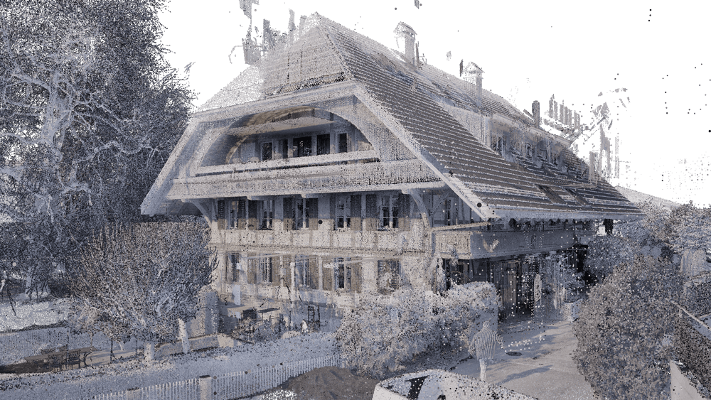
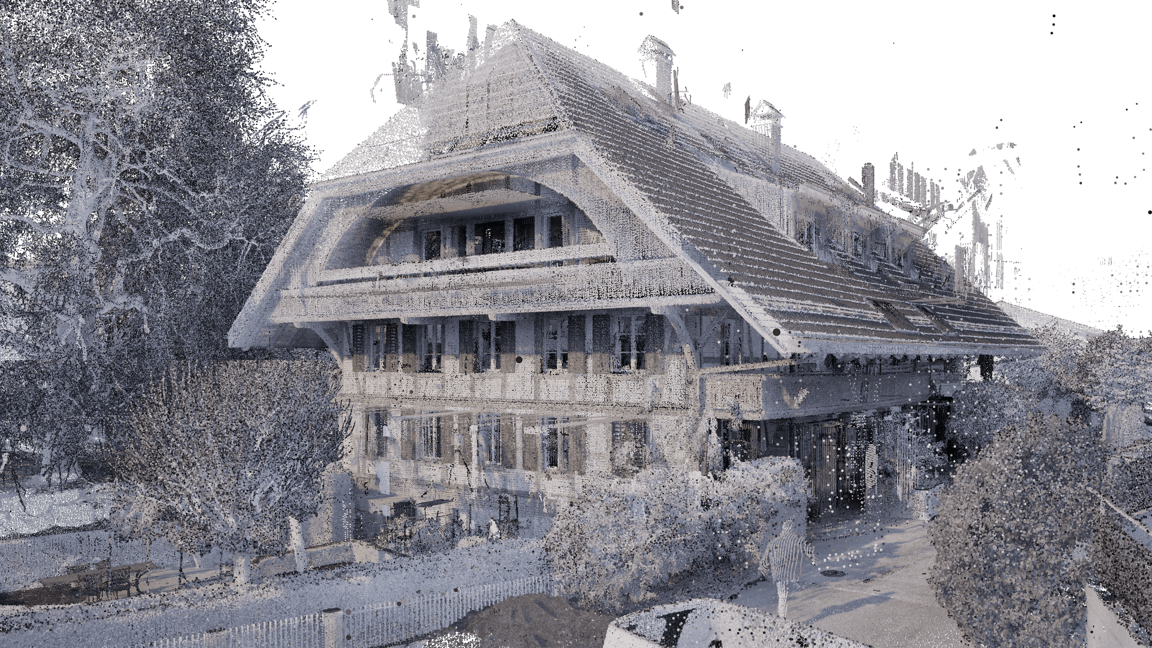
Each scan captures millions of measurement points that represent the visible surfaces of a building in three dimensions: walls, ceilings, floors, façades and numerous other building elements.
However, a single scan is rarely enough to capture an entire building. Depending on size and complexity, dozens or even hundreds of scan positions are required. This is where one of the most important challenges begins.
2. Many scans become one combined point cloud
To create a complete digital representation, all individual scans are merged into a common coordinate system. This process is called registration. The scans are aligned with each other based on shared geometric features and additional survey information.
Although each scan measures very precisely, additional deviations can occur when the scans are merged. In our experience, these deviations in a registered point cloud are often in the range of approximately 1 cm, depending on the project and the site conditions.
In large buildings with many scan positions, small deviations can also accumulate from one position to the next. A long corridor or an extensive site is therefore more demanding than a single room.
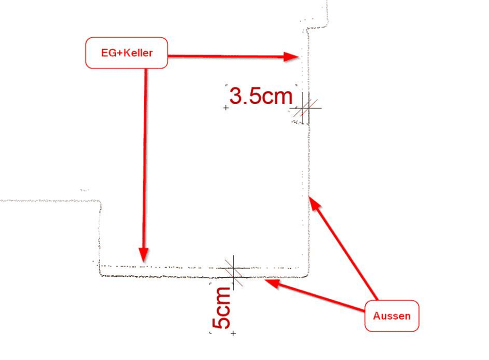
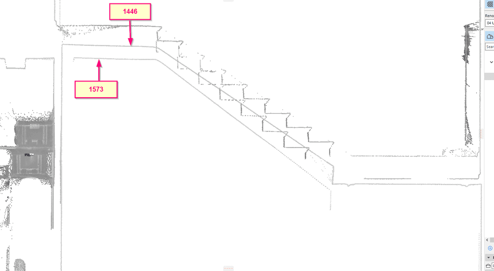
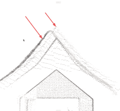
Even a point cloud with good statistical registration values can contain local offsets. Wall surfaces captured from different scan positions then lie slightly offset from one another. Such deviations are not always immediately visible, and if they go unnoticed during modelling, they directly affect the geometry of the as-built model.
3. Why automatic registration alone is not enough
Modern registration software merges scans largely automatically and calculates how well the individual scans fit together geometrically. These values are an important basis for quality assurance, but they do not replace expert review of the registered point cloud.
An example: two scan positions capture the same wall. After automatic registration, the point clouds lie slightly offset from each other in one area. The software still reports good overall values, because the local deviation barely registers in the average across the entire project.
If this offset goes undetected, the wall may be misinterpreted during modelling. For large and complex existing buildings in particular, targeted quality control is therefore essential.
4. VDE quality control: experience from over 2,000 projects
Over many years, VDE has developed its own workflow for checking and optimising registered point clouds. More than 2,000 projects have shown us where registration problems occur most frequently.
Our team therefore does not rely solely on the calculated registration values. They specifically check the combined point cloud for local offsets and geometric inconsistencies, particularly where different scan positions meet or where deviations could affect the subsequent modelling.
Relevant offsets are analysed and corrected. This reduces the risk of undetected registration errors being carried over into the finished CAD or BIM model. The quality of a point cloud therefore depends not only on the software, but to a large extent on the experience of the people who review and process the data.
5. From point cloud to 3D as-built model
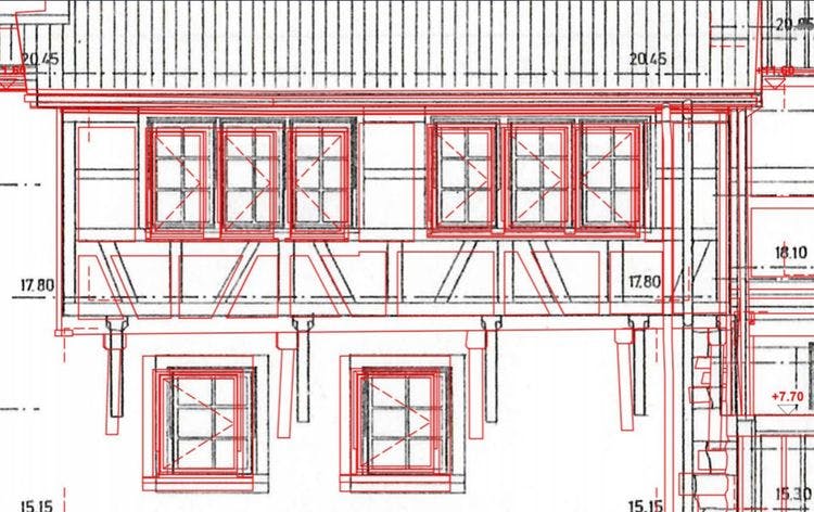
Once registration and quality control are complete, modelling begins. Millions of measurement points are turned into a structured 3D as-built model in which walls, ceilings, floors, windows, doors and roof structures are built as CAD or BIM elements. VDE models natively in ArchiCAD, Vectorworks, Revit and Allplan, among others.
A point cloud represents measured surfaces. A CAD or BIM model, by contrast, consists of geometrically interpreted building elements. In between lie professional decisions: How should an irregular wall be represented? How are deformations taken into account? Which geometric features are relevant?
Depending on the agreed modelling standard, building elements are represented as deformed or straightened within defined tolerances. That is why we clearly distinguish between measurement accuracy, modelling accuracy and deliberately simplified geometry.
6. What counts is the accuracy of the finished model
For architects and planners, what matters is not the accuracy a single laser scan can achieve, but how reliably the finished 3D as-built model can be used as a planning basis.
As standard, VDE guarantees an accuracy of ±2 cm for the finished 3D as-built model. By prior agreement, ±1 cm is also possible. These values refer to the geometry as represented according to the agreed modelling standard; deliberately agreed simplifications and straightening must be taken into account accordingly.
- Capture: precise measurement with professional laser scanners
- Registration: careful merging of the individual scan positions
- Review: targeted inspection of the combined point cloud for local offsets
- Correction: elimination of detected registration deviations
- Modelling: professional construction of the CAD or BIM model
- Final check: quality control of the finished as-built model
What ultimately counts is not the technical accuracy of a single instrument, but the quality of the entire process.
7. Why this distinction matters for architects
A reliable as-built model is the foundation for conversions, renovations, extensions and the coordination of different specialist planners. If geometric deviations are not detected during surveying or modelling, they carry over into the planning. The consequences are additional coordination effort, design changes or problems during construction.
- Ask your surveying partner: How are the individual scans registered?
- How is the combined point cloud checked for local offsets?
- What quality assurance takes place before modelling?
- What accuracy is guaranteed for the finished 3D as-built model, and what does it refer to?
- Which modelling standards are applied?
Only these answers allow a well-founded assessment of the service on offer.
8. Accuracy is not the same as level of detail
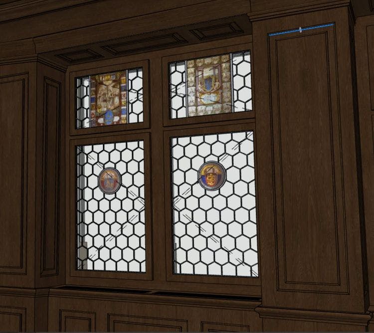
A model can be geometrically very accurate and still be deliberately simplified. A historic window can be modelled as a standard library element or recreated with its individual profiles and characteristics. Both variants can meet the same accuracy requirements; the difference lies in the level of detail and the modelling effort involved.
VDE therefore distinguishes between the accuracy of the model and the agreed drawing standards. Which details are needed depends on how the model will be used later. Find out more in our article on level of detail and drawing standards for 3D as-built models.
Conclusion: accuracy is created by the entire process
Modern laser scanners deliver highly precise measurement data in the millimetre range. However, the quality of the end product is determined by the registration of the individual scans, the targeted review of the combined point cloud and professional modelling.
Based on more than 2,000 projects, we have developed our own quality control processes for this purpose. Our aim is not just a precise measurement, but a reliable 3D as-built model: with a guaranteed accuracy of ±2 cm as standard, and ±1 cm by agreement.
Do you need a reliable basis for your conversion or renovation? VDE supports architects, planners and building owners with professional building surveys and high-quality 3D as-built models.