


More Blog Posts
Villa Digital
Engineering AG
Tittwiesenstrasse 21
7000 Chur
Alte Landstrasse 248
8708 Männedorf
Zugerstrasse 53
6340 Baar
Neugasse 12
9000 St. Gallen
5,017 laser scans for a digital twin: The IOE campus in Otelfingen
134,971 m² of land area, 40,476 m² of building area, and 5,017 laser scans
Whenever we discuss projects internally that have left a lasting impression on us, sooner or later the conversation always turns to the IOE site in Otelfingen. Not because individual parts of the buildings were particularly complicated or because we had to develop extraordinary custom solutions. Rather, it was the sheer scale of the project that was impressive. It’s rare to find such a large area, multiple buildings, thousands of scan positions, and such a closely coordinated team all coming together.
In the summer of 2022, we were commissioned to fully digitize the industrial site at Industriestrasse 19, 21, and 23. The goal was to create a digital twin as the basis for future renovation planning and the long-term development of the site.
A Project of Extraordinary Scale
Even the initial key figures show why this project remains one of the largest industrial projects we at VDE have had the privilege of carrying out to date. The project encompassed five parcels with a total land area of 134,971 m². These parcels contain three industrial buildings with a total floor area of 40,476 m², which were fully digitally surveyed and modeled.
In addition to the buildings, all relevant outdoor areas were also surveyed. These included, among other things, rail tracks, walls, shafts, power poles, streetlights, trees, and other site features. This resulted not only in a building model but in a complete digital twin of the entire industrial site.
Even during the project preparation phase, it was clear that the biggest challenge would not be a single building, but rather coordinating a project of this magnitude.
5,017 laser scans in just one week
What continues to impress me personally to this day is the speed with which our team carried out this project. Three surveying specialists captured the entire site in just five workdays. The result was 5,017 scan positions, recorded using three RIEGL VZ-400i laser scanners.
Anyone who works regularly with 3D laser scanning knows what such a number entails. Every single scan must be planned, captured, checked, and later registered. Even a few hundred scan positions place high demands on data organization. With over five thousand scans, the resulting data volumes can only be processed efficiently with clearly defined processes and a well-coordinated team. When we examined the complete point cloud after completing the survey, we truly realized the actual scale of this project.
The real challenge began after the survey
However, data collection was only the first step. The real challenge was to transform the enormous volume of data into a usable digital twin.
While the surveying was complete, modeling had already begun in parallel. A total of 15 modelers worked on the digital implementation. Over 2,234 modeling hours went into creating the overall model.
Looking back, it was precisely this interplay between surveying and analysis that was the most impressive aspect of the entire project. After all, a digital model of this magnitude is not created by individual specialists, but through perfectly coordinated teamwork. Each modeler works on a specific section, while standards, structures, and interfaces must remain consistent at all times. Only in this way can a model be produced that can reliably serve as a basis for planning.
Large-scale industrial projects in particular demonstrate that modern laser scanning technology alone is not sufficient. It is only through close collaboration between surveying, data management, and modeling that millions of measurement points can be transformed into a true digital twin.
From Laser Scan to Digital Twin
The goal of the project was far more than a traditional as-built survey. The client needed a digital foundation for future renovations and the long-term development of the entire site.
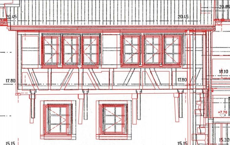
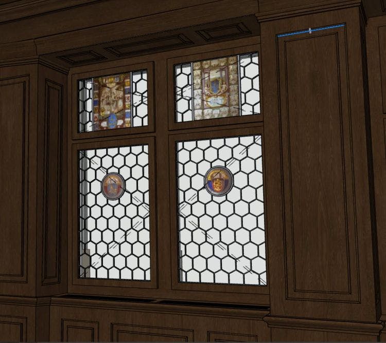
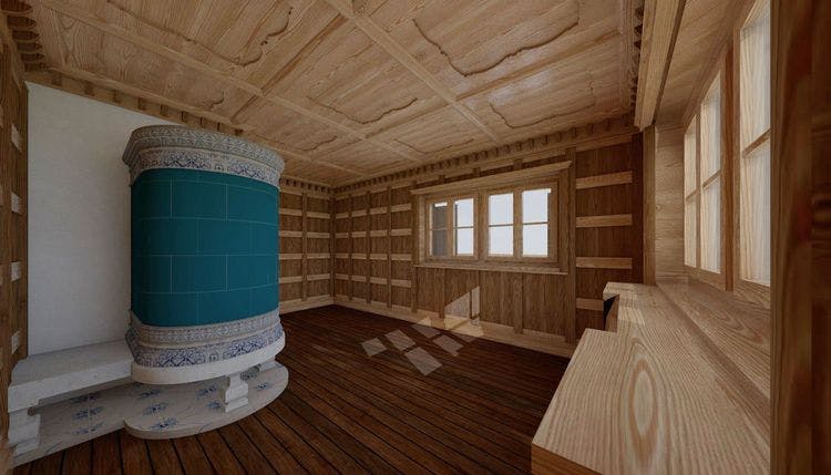
Therefore, all three industrial buildings were reconstructed as detailed 3D models in Vectorworks. In addition, a comprehensive terrain model was created that depicts the entire surrounding area, including infrastructure and outdoor facilities.
The scope of delivery included, among other things:
• Complete 3D models of the buildings
• Facades, including joint patterns
• Material assignments for walls, floors, and ceilings
• IFC models
• registered E57 point clouds
• RiPANO 360° viewer
• complete terrain model
This provided the client with a digital twin that goes far beyond traditional surveying and serves as the foundation for future planning and renovation projects.
Teamwork as the Key to Success
When I look back on this project today, the first things that come to mind aren’t the over 134,000 m² of land area or the 5,017 scan positions. I think of the collaboration within our team. Three surveyors on-site and 15 modelers in the office worked hand in hand to turn a massive point cloud into a precise, structured, and usable BIM model.
For me, it is precisely this collaboration that defines the true success of this project. It demonstrates that large-scale industrial projects require not only high-performance laser scanners, but above all experienced staff, clear processes, and a perfectly coordinated organization.
A Digital Twin as the Foundation for the Future
Industrial sites are constantly changing. Buildings are expanded, production lines are adapted, and uses are modified. With a digital twin, all relevant as-built data is permanently available. Planners, architects, and building owners can work on a precise foundation without having to conduct extensive surveys all over again for every issue that arises.
The IOE site in Otelfingen impressively demonstrates the potential that modern building surveying, 3D laser scanning, and scan-to-BIM offer today. To this day, it remains one of the projects we are particularly proud of—not only because of its size, but above all because of the teamwork behind it.
Are you planning to digitize an industrial site?
Whether it’s a production facility, a logistics center, or a complex industrial site—VDE supports companies, architects, and planners in creating precise digital twins.
Using state-of-the-art 3D laser scanning, scan-to-BIM, and over ten years of experience, we create the digital foundation for confident decision-making and successful renovation projects.