Who is actually responsible if point cloud data leads to inaccurate planning?
Who is actually responsible when point cloud data leads to inaccurate planning? Or why we check all point cloud data again before modelling.
In recent years, the automatic registration of point cloud data has improved massively. What used to be a much more manual process a few years ago, where many scan positions had to be fitted individually, now happens almost automatically with skilful positioning during on-site recording.
That's great, isn't it? Yes, it is.
But it also brings with it a risk that is unknown to many.
Point cloud data can contain shifts even after autoregistration and fine calculation, and this is very often the case. Yes, often even after the software's own report has given the green light.
The difficulty here lies in finding and recognising these. We have been doing this for over 10 years and it is one of our specialities.
Why is this important?
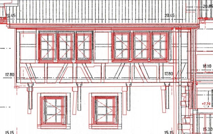
Because otherwise these shifts are unconsciously transferred to the 3D model or the 2D plans. If this is not done, and believe it or not, you will otherwise have minimal deviations from the on-site image, plus the sometimes serious displacements from the unconsciously misaligned point cloud data.
These shifts would come to light at the latest during the execution.
But this is too late.
How do we solve this?
On the one hand, we know from hundreds of projects where the shifts mentioned are often hidden, and we always check these first.
We also work with specially developed tools to synchronise the scan positions and find shifts of up to 2-3 mm.
The next step is to align the height of the roof to the height of the site survey and then check this alignment using thin cross sections in the horizontal and vertical planes to ensure the correct height to complete the task.
Laser scanning is very precise
Point clouds are great
But only cleanly registered data guarantees your planning reliability.
And that's exactly what we're here for.


