Multiple buildings · Entire sites · Site-wide referencing

Large-Scale 3D Projects & Site Developments

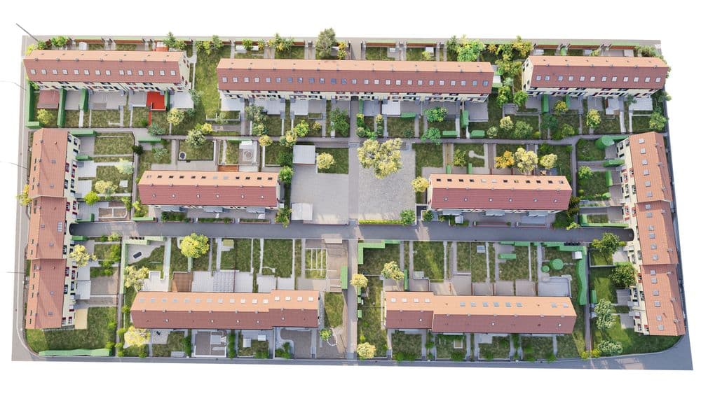
3D as-built models for large-scale projects and site developments capture multiple buildings, properties, or an entire site in a single, georeferenced model. VDE surveys not only individual buildings but entire building complexes and consolidates everything into a consistent digital foundation. The result is a site-wide as-built model that architects, general planners, site developers, and investors can use as a common foundation for their work.
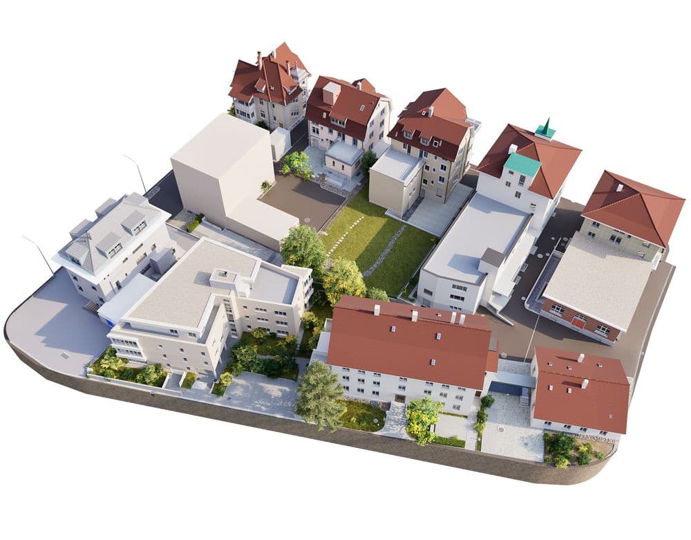
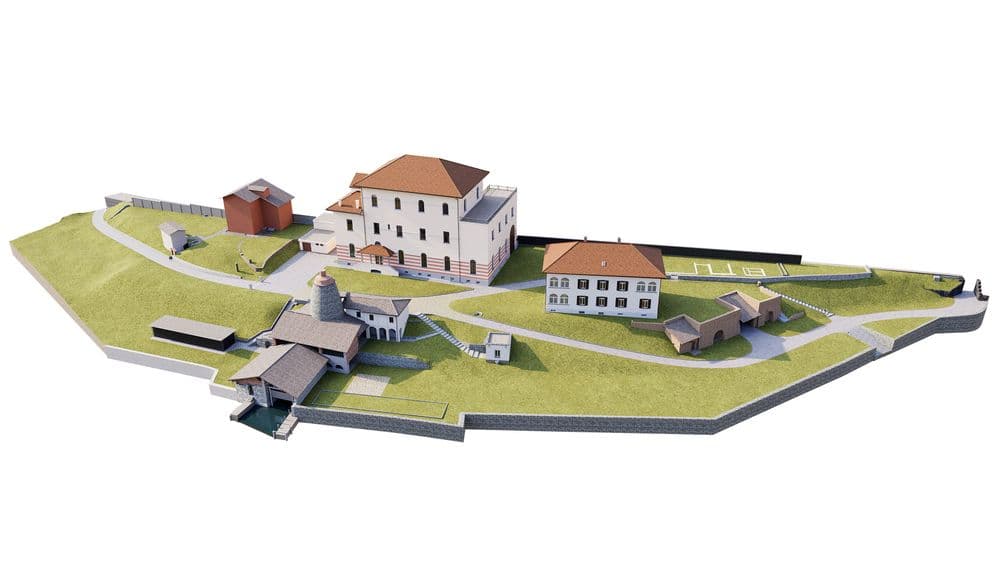
Case Study: Kernstiftung Site, Rapperswil

Initial Situation The Kernstiftung Rapperswil is planning the comprehensive development of its existing site, which comprises several buildings of varying ages and conditions. A consistent, site-wide digital as-built documentation was lacking as a basis for the site development—both for strategic planning and for assessing remodeling, renovation, and replacement construction.

Solution VDE surveyed the entire site using 3D laser scanning and created a detailed as-built model with targeted levels of detail based on relevance to the development:

  • Main building – complete 3D model of the interior and exterior as a precise basis for planning
  • Demolition site – as a volumetric model for spatial context within the overall site
  • Ancillary buildings – simplified exterior models with windows, doors, and roof structures to provide a cohesive overall view

The result is a site-wide, coordinated 3D model that provides all stakeholders with a common data foundation.

Result The planning team, investors, and client have a shared, realistic representation of the site—serving as the foundation for feasibility studies, land-use concepts, and further project development. The tiered level of modeling detail enabled a cost-effective solution that is precise exactly where it matters.

“Not every building needs the same level of detail—but each must fit coherently into the overall model.”

What a site model can do that individual models cannot

Modeling individual buildings separately does not solve the fundamental problem with site-wide projects: Without a common coordinate system, the spatial relationships between buildings, access routes, and open spaces are lost.

A site model brings all buildings together in a georeferenced manner—this is what makes land-use potential, building relationships, and development scenarios visible and planable in the first place.

Typical Projects

Plans from Different Eras Large sites rarely develop all at once. Decades of expansions, renovations, and modifications result in plans with varying scales, reference systems, and update statuses. A consistent overall view is lacking.

Lack of a Land Area Basis Land area balances, floor area ratios, and land-use proportions can hardly be reliably determined from old individual plans—the basis for development decisions is missing.

How Your 3D Site Model Is Created

Site-Wide Laser Scanning Survey The entire site is systematically surveyed—using terrestrial scanners and, depending on the size of the site, multiple scanners simultaneously. All buildings are recorded within a common georeferenced coordinate system. No building is considered in isolation; everything is viewed in context.

Consistent 3D Master Model Buildings, infrastructure, outdoor spaces, and elevation relationships are modeled across the entire site and coordinated with one another. The result is a spatially consistent overall representation of the existing conditions.

**Area Analyses** The model enables immediate evaluations: floor areas, usable areas, and room volumes—structured, reliable, and directly usable for feasibility studies and user requirements programs.

What the Site Model Does

Spatial overview at the site scale Building relationships, access routes, elevation changes, and open spaces become visible in context—the foundation for sound development decisions.

A Common Foundation for All Stakeholders Architects, developers, and investors work from the same digital foundation. No loss of information, no contradictions between different planning stages.

Foundation for Land-Use Planning & Scenarios Development scenarios, land-use distributions, and the extent of development can be simulated using the model—before costly planning steps are initiated.

Typical Projects

  • Large-scale site developments and transformation projects
  • Campus facilities, universities, schools
  • Large-scale residential developments within existing neighborhoods
  • Historic neighborhoods and ensembles
  • Hospital complexes and medical infrastructure
  • Commercial and industrial sites with multiple buildings
  • Complex multi-property developments

Who Should Use 3D CAD Models?

Site models are used in situations involving multiple buildings, large areas, and many stakeholders:

  • Architectural and general planners
  • Site developers
  • Real estate owners
  • Investors
  • Developers of large-scale transformation projects
  • Cantons & Municipalities

VDE and Large-Scale Projects

For over fifteen years, VDE has specialized in the digital surveying of large building portfolios. Our workflows are designed to efficiently survey entire sites, georeference and consolidate the data, and convert it into consistent planning foundations—with projects throughout Switzerland.

Villa Digital
Engineering AG

Tittwiesenstrasse 21
7000 Chur

Alte Landstrasse 248
8708 Männedorf

Zugerstrasse 53
6340 Baar

Neugasse 12
9000 St. Gallen


mail@vde.ch